Mapping – Geoscience Archive
Mapping, GIS and terrain software from Geologynet.com
Digital Terrain Viewer
A DEM viewer for SRTM DEM Data. Freeware. View SRTM tiles in 3D, supports GTOPO30, ETOPO5 and GPS track overlays.
? Live
Web Links
Digitizer (Engauge)
PC Digitizer — digitize scanned images, graphs, maps etc. Open-source and actively maintained.
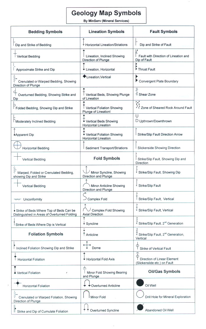
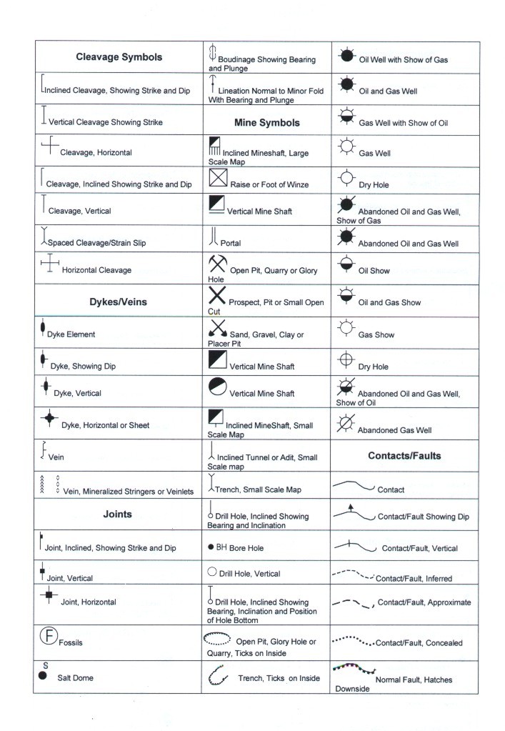
Geology Map Symbol Chart (JPEG)
Geology Map Symbol Chart A4, 2 pages. Compatible with all Geology Fonts/Maps.
? Live
Download (.zip)
View Page 1
View Page 2
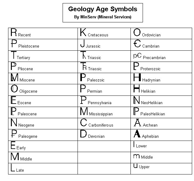
View Age Symbol Chart
QGIS
Open source GIS software for viewing, editing and analysing GIS data. Cross-platform, free and widely used in geoscience.
? Live
Web Links
USGS Spectral Library 4a
Mineral spectral data — USGS Digital Spectral Library Version 4a, reflectance spectra of minerals.
NGS (NOAA) Geodetic Toolkit
Various Coordinate Conversion Programs (Geodetic) — National Geodetic Survey tools for datum transformations, coordinate conversion and GPS utilities.
? Live
Web Links
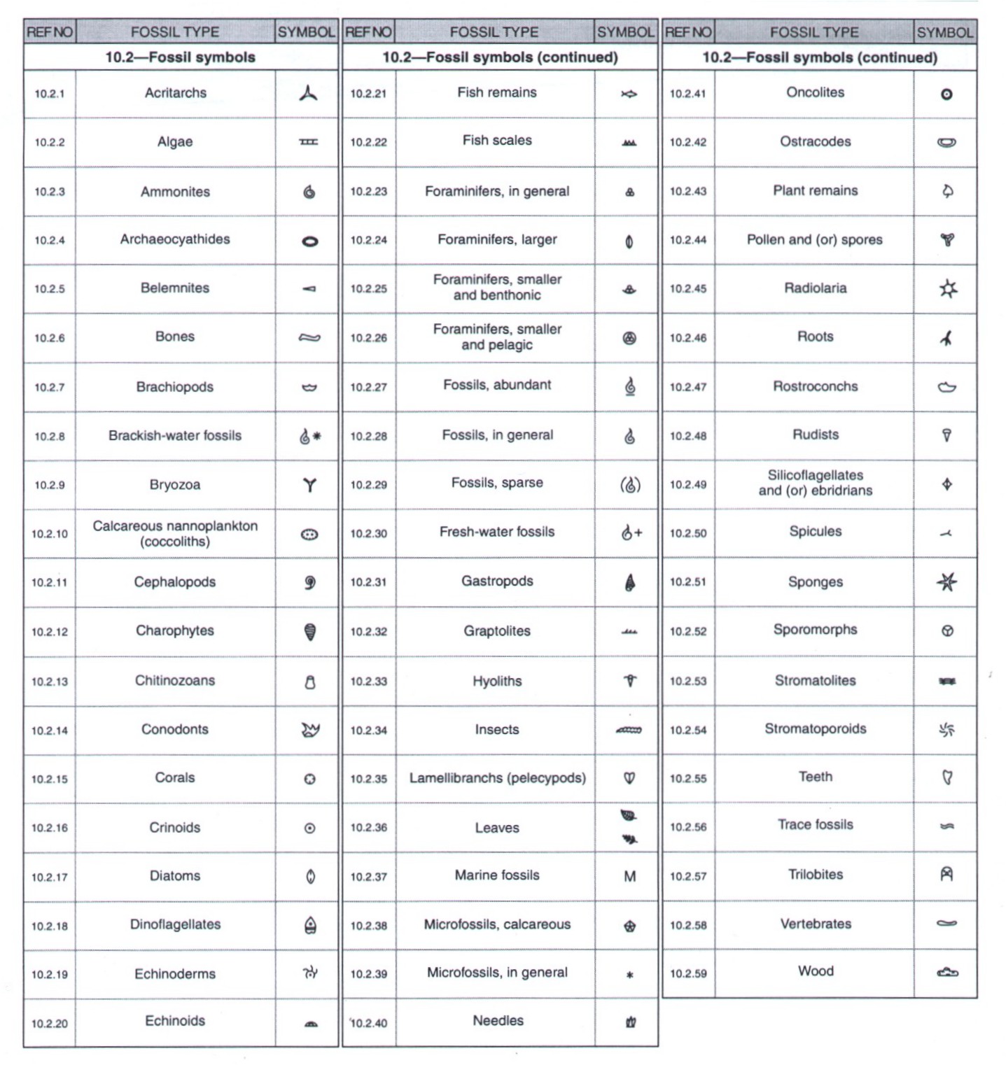
Paleontology Map Symbol Chart (JPEG)
Chart of Paleontology Symbols for Core Descriptions/Maps. From USGS OF99-430.
? Live
View Chart
Pattern Library
USGS Geologic map patterns — vector-based geology patterns in PDF.
? Live
USGS Web Link
SPView
A mineral spectra viewer program for USGS Spectral Data. Originally accessed via USGS FTP.
? Updated — old USGS FTP (ftpext.cr.usgs.gov) is defunct. The USGS Spectroscopy Lab has moved to crustal.usgs.gov/speclab/ — Spectral Library Version 7 and related tools are available there.
USGS Spectroscopy Lab
Spectral Library v7